Overview
A low exited the mid-Atlantic region and is forecast to hug the Northeast coast before heading out of the picture. As this low moves up the coast, look for a solid windswell/groundswell to fill in to exposed coastlines. Conditions will be pretty raw since the low is so close to land. 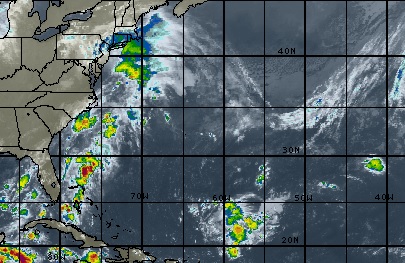
Storm Details
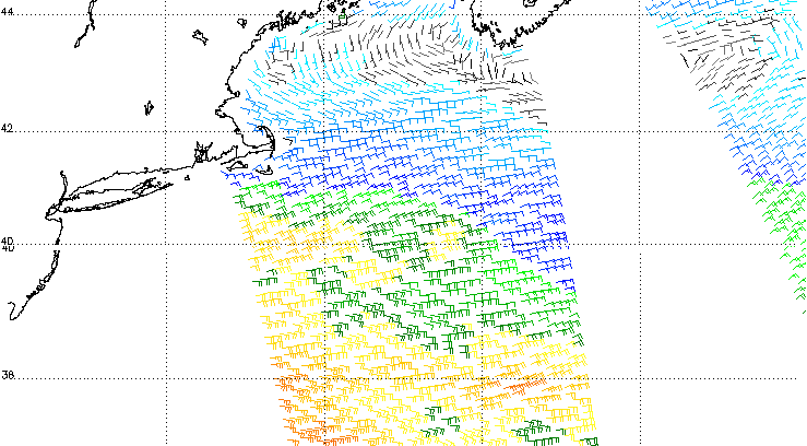
This low is creating a SOLID fetch pointed at the Long Island/NJ region. Watch this low to move up the coast, bringing elevated surf to beaches exposed to easterly swell. Weather will be an issue, with blustery, rainy conditions predicted for most of the day on Thursday. As the low departs, look for winds to decrease and conditions to improve. Long Island looks like the place to be with NE winds forecast for much of the swell.
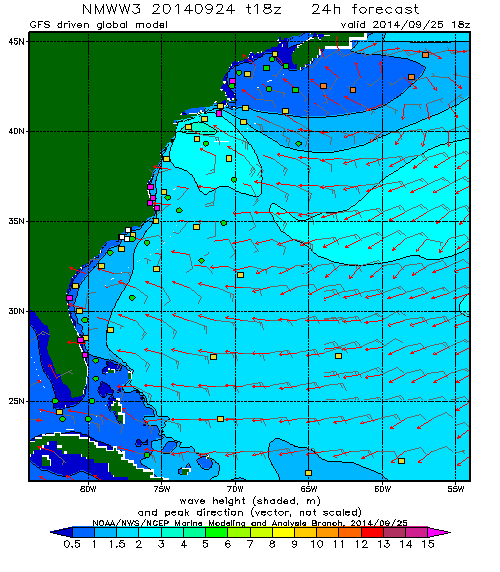
As seen in the graphic from WaveWatch3 below, this low is forecast to be a powerful swell builder for the region. This swell should peak in the evening hours on Thursday, but look for it to stay in solid range for Friday before fading over the weekend. Flat by Monday.
New York/New Jersey Forecast
(North Jersey and Long Island)
Conditions deteriorate quickly on Thursday as the storm reaches the New York Metro area. Look for rain and heavy winds until the storm makes it’s way out to sea on Thursday afternoon/evening. Winds will be mostly side-shore to begin, but as the storm moves away, a more northerly component will creep in to the wind. That northerly wind trend should continue as high pressure builds in to the region for the weekend. Good winds for Long Island…but onshore for NJ.
Thursday: Rapidly building surf with heavy side-shore winds. Bordering on Victory-at-Sea conditions through midday. Watch the flags for the wind switch in the afternoon and be ready to get a session as the wind comes around for Long Island. Surf in the head high to well overhead range. Protected spots probably the best idea. NJ remains messy and big.
Friday: NE winds remain pretty strong and gusty as the low departs. Surf continues to clean up for Long Island and stays in the chest to head high+ range. NJ might have a chance if winds are lighter than forecast.
Saturday: Wind and swell continue to fade. Cleaner, smaller conditions with NE winds and a waist to chest high swell. Again, NJ might have a chance if winds are lighter than forecast.
Sunday: Clean with N winds in the morning with a small waist high swell. Swell drops and winds switch for the afternoon. NJ will likely be clean in the morning with light winds.