Overview
Two cold fronts will pass through the Florida peninsula this week, ushering in the coldest air of the season to date. Record low temperatures are possible on Wednesday night through Friday morning with lows in the 40’s and highs in the 60’s. These will create advancement of cold, northerly flow in a series of shots on Wednesday and Thursday. Break out your wetsuits!
Front #1 – Tuesday Night
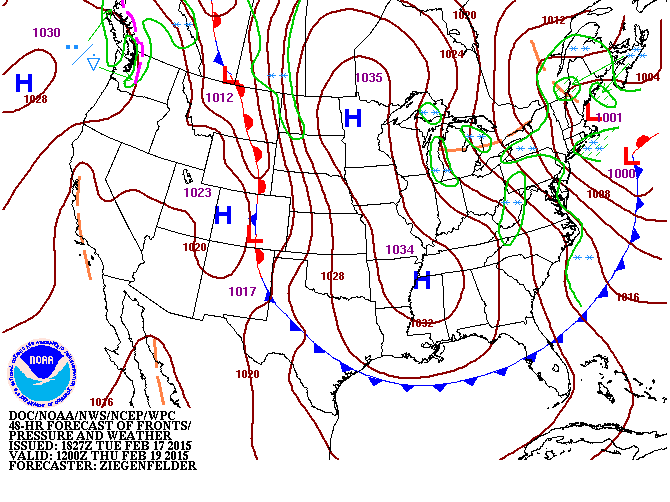 Front #2 – Thursday Morning
Storm Details
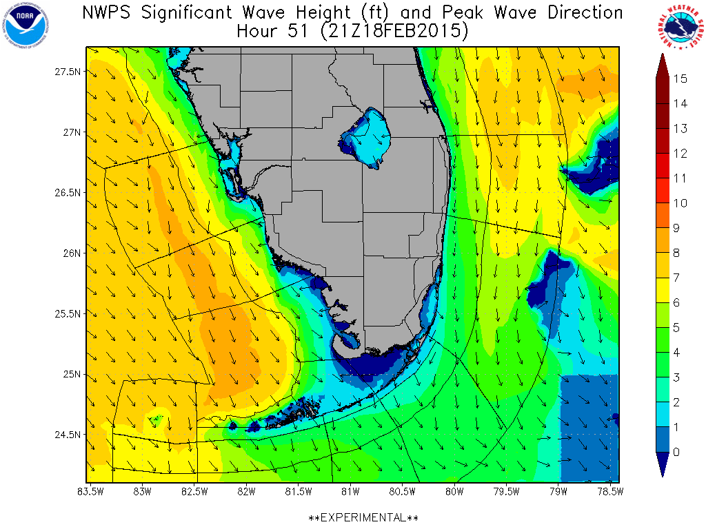
High pressure building in to the region will create strong NW winds, building a NW to N swell to start arriving on Wednesday and lasting through Friday. You can see the swell arriving Wednesday evening on the forecast map below.
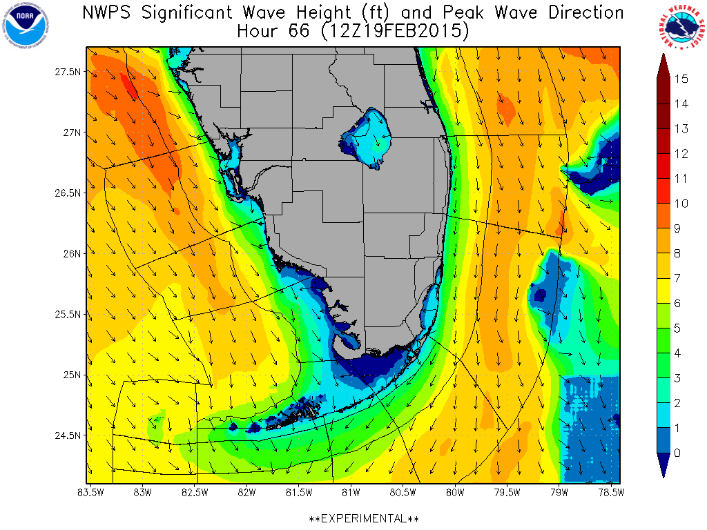
The forecast map below for early Thursday morning shows the swell building as the winds upcoast continue to create fetch with the reinforcing cold front. It should be pretty cold down here, but at least it looks like some waves, too!
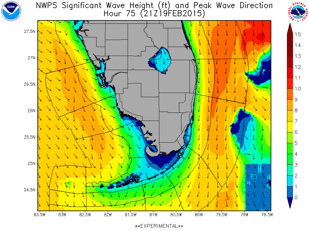
 This swell should peak on Thursday evening at about 8 feet at 8 seconds- which is similar to the numbers we saw on last week’s Wednesday swell. As of now, it looks like the winds will start to veer more NE on Friday. I’m hoping that we have a window of better winds early on Friday morning- it seems like that’s usually the case for far South Florida with these scenarios. Look for winds to stay elevated but more Easterly as we head in to the weekend.
Florida Forecast
(South Florida)
Winds come up out of the NW on Tuesday night way upcoast starting the building of swell. Winds will stay in the 15-25kt range out of the NW until veering more NE on Friday. Swell being generated for South Florida. Look for the swell to arrive late Wednesday and build through Friday. Easterly windswell for the weekend.
Wednesday: Flat in the morning, building to a trace by mid-day. Possibly a small rideable bump by dark. Winds NW and strong.
Thursday: Probably not much more than waist high in the morning, but building. Could get up in to the chest+ range by evening. Winds NNW and strong.
Friday: Chest to Shoulder+ with strong N going NE winds. Pay attention to the wind forecast, as we could see better conditions than currently forecast.
Saturday: Easterly windswell in the thigh to waist high range.
Sunday: Fading easterly windswell. Knee high+