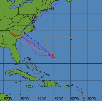
Woohoo! We have waves in the forecast from a developing low pressure system (#91L) near the Bahamas. As of Thursday afternoon, the models are consistently showing a low forming Friday into Saturday that tracks WNW and then NW toward the South Carolina coast making landfall on Sunday. Until recently, winds were forecast to reach 25 kts, but the forecasted intensity has been increased and winds have also been adjusted upwards. We could have #TSBonnie when #91 develops this weekend!
Based on the latest information, it looks like a similar set-up to Tropical Storm Ana of 2015. That storm created a fun surf for Central and North Florida, but South Florida didn’t see any swell. The initial part of this swell will likely favor spots in the northern part of the state, and then spread further south as the swell direction starts to pick up a more northerly component as the storm moves up the coast. Given the current wind strength forecast and track, it looks like waist to shoulder (maybe bigger!) at top spots with fairly light winds for Saturday and Sunday.
The intensity and track of this storm is still uncertain, so exact details of the forecast will be updated as information is available. Stay tuned to @thankyousurfing
Best bet?
Head way upcoast for the first part of the weekend and then head south with the swell.