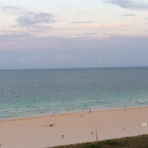
It’s spring. That means we need to start watching the wind for those rare times it gets rideable! We were lucky to catch some fun SE windswell earlier this week, but this weekend is looking pretty flat in Florida. There could be some fun longboard waves way upcoast, but minimal. Watch for the wind to come up Sunday afternoon, possibly…
Category: Forecasting
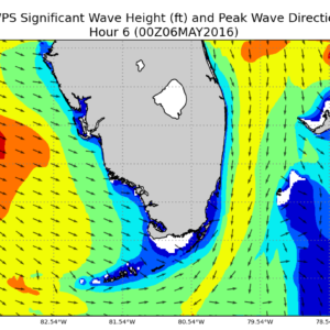
ThankYouSurfingThursday – May 05 2016
The small north swell that arrived today from the cold front will be on the fade as we go through Friday. Dawn patrol will be your best bet- if there’s anything left at all. Surf forecast for Saturday and Sunday is for flat or nearly flat conditions all over Florida. Best bet? Friday morning in the Palm Beaches or locally…
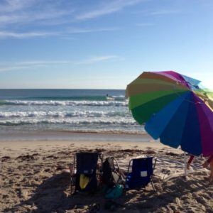
ThankYouSurfingThursday – April 28 2016
Surf forecast is for flat or nearly flat conditions for South Florida this weekend. There will be some minor Easterly background swell up above the Bahama shadow, but only knee high or so. Wind is lightest on Saturday. Maybe some small building SE windswell for Sunday. Best bet? Waaaay upcoast with longboard, fish, or SUP on Saturday morning. Maybe bring…
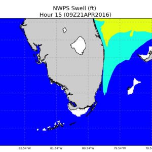
ThankYouSurfingThursday – April 21 2016
On Friday, possible small SE windswell locally. Upcoast will be in the fun zone with some uptick in NE groundswell. Up to shoulder high or so in Central Florida with onshore wind 5-15 kts out of the SE. Saturday is looking flat in South Florida with some fading groundswell for upcoast spots, but still very rideable. Wind is looking really…
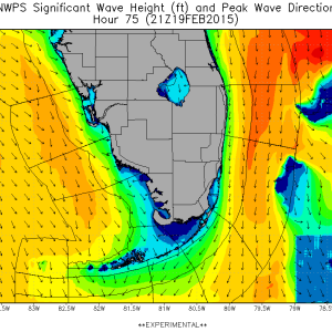
Cold(est) Fronts
Two cold fronts will pass through the Florida peninsula this week, ushering in the coldest air of the season to date. Record low temperatures are possible on Wednesday night through Friday morning with lows in the 40’s and highs in the 60’s. These will create advancement of cold, northerly flow in a series of shots on Wednesday and Thursday. Break out your wetsuits!
A Low, a Cold Front, a Cold Front…and another Cold Front?
the forecast for this week is pretty tricky due to the number of features impacting our area. Tuesday, watch for increasing North swell. The buoys upcoast should start picking up energy all day and through the evening peaking in very early Wednesday morning at nearly 8 feet at 8 seconds from almost straight north.
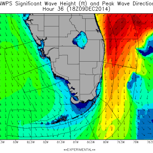
Big Nor’Easter Swell
Overview A trough from the Great Lakes to the Northern Gulf is forecast to move eastward and create conditions for more cold air to stream down the Florida Peninsula as we move through Monday night and in to Tuesday. The pressure gradient between this feature and a low deepening off the Mid-Atlantic/Northeast has created a significant Northeast fetch pointed at…
Weekend East-Northeast Swell
Overview A low off the Mid-Atlantic interacting with a High Pressure advancing Northeast will set up a nice gradient of North to Northeast winds targeting the Florida coast. It’s not a major storm, so we’re not expecting huge numbers- but it should get in to the fun-sized range this weekend. Winds may not entirely cooperate, but we may see some…
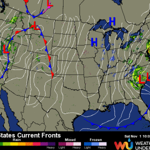
Cold Front, Cold Front
Overview A cold front passed through the Florida peninsula bringing dry, cool air in to the region. Another, stronger cold front is currently making its way south. Currently, the front is pushing through Lake Okeechobee and is bringing another shot of colder air along with Northwest/North winds. This feature, combined with a rapidly deepening low off the Mid-Altlantic coast, will…
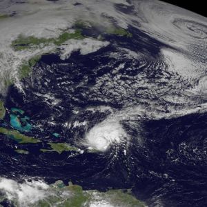
Hurricane Gonzalo
While the cold front draping across the Southeast and the broad low in the North Atlantic may be indicative of Fall, we have a serious tropical system in the Atlantic Basin just Northeast of Puerto Rico.
