Overview
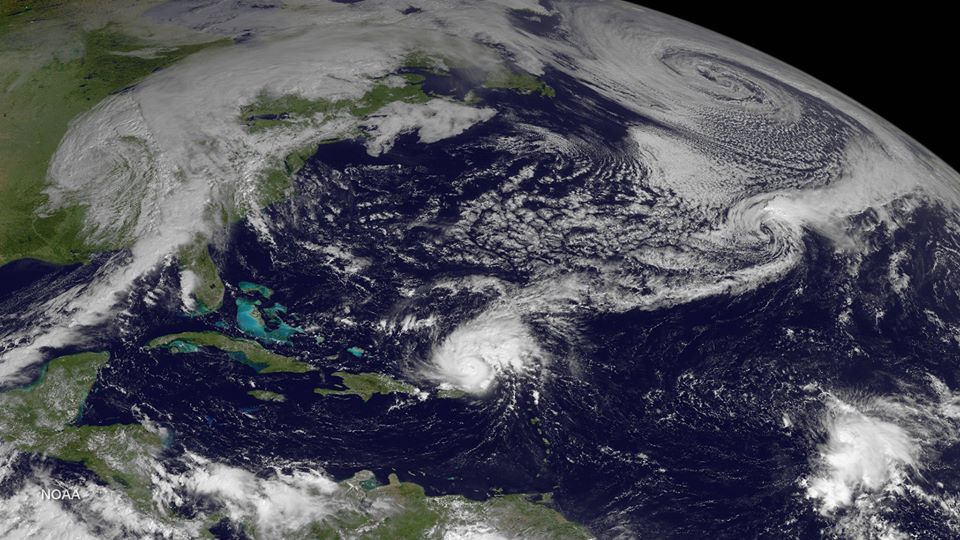
While the cold front draping across the Southeast and the broad low in the North Atlantic may be indicative of Fall, we have a serious tropical system in the Atlantic Basin just Northeast of Puerto Rico. Hurricane Gonzalo is now a major hurricane with 115mph sustained winds moving Northwest over warm water with favorable conditions for strengthening.
 Storm Details
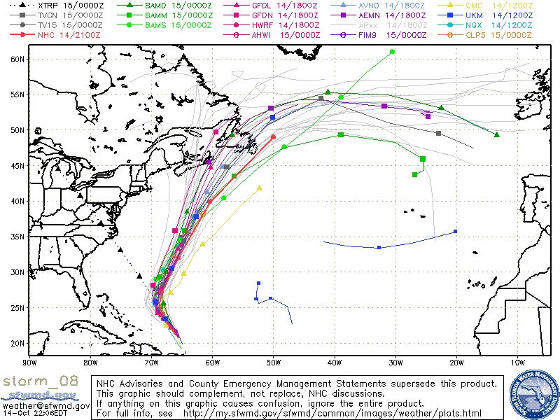
Hurricane Gonzalo’s eye has contracted and become more distinct in satellite, radar, and recon wind data, so the system appears primed for intensification to Category 4 status in the coming days. The track seems fairly certain to maintain a Northwest motion at about 13 mph through Wednesday, but on Thursday afternoon the storm should begin a track to the North and then steadily Northeast as it is moves out towards Bermuda with the cold front. The storm has a fairly wide circulation and is forecast to strengthen significantly, so interests in Bermuda should monitor this storm closely.
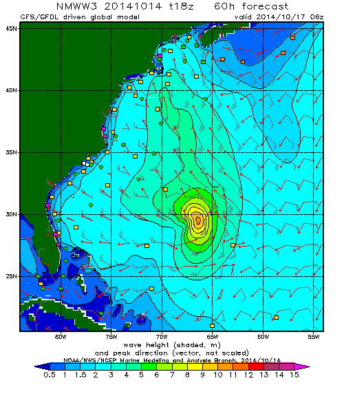
Hurricane Gonzalo is a powerful storm, but due to it’s limited Westward movement, isn’t putting down wind in Florida’s window for too long. The East Coast up through New England will see a more powerful swell as the storm travels toward their coastline for a longer time period and with stronger winds. Regardless, the whole East Coast will get a good spray of tropical juice at the end of the week and in to the weekend.
Florida Forecast
(North of Treasure Coast)
Gonzalo swell is set to start pinging buoys tomorrow late-morning in to the afternoon hours. Look for small swell in the 14 second range on the Canaveral East Buoy first, then on the Canaveral Nearshore Buoy about 3 hours later. There will also be a bit of old windswell showing on the buoys at about 2 foot at 9 seconds, so it may be hard for the buoys to pick it up the new swell. Look for Gonzalo’s swell to fill in quickly overnight in to Friday morning with the buoys hitting a peak of about 5 feet at 13 seconds from the ESE late in the night. The swell will continue through the weekend slowly diminishing in size and picking up a more northerly tilt allowing the swell to filter down the coast a bit.
Thursday: Small to very small through midday and then a constant increase through the late evening as the Gonzalo swell starts showing. If the swell shows up on time, it could be in the chest to head high range in the evening. Winds look good if it happens.
Friday: Peak of the Gonzalo swell. Head high to Overhead with NW winds. It’s a groundswell, but not an extremely large or long period swell so it shouldn’t be too hard to find a spot that’s working. Looks like a good day to search and score in Central Florida!
Saturday: Surf in chest to head high range in the morning fading through the day. Winds are forecast to be light/offshore and then light onshore late. Fun sized surf for much of the upcoast spots with good winds.
Sunday: Gonazalo’s leftovers will make for a nice little Sunday with the right attitude and equipment. I wouldn’t doubt some waves in the shoulder high range early if you can sniff out the right spot and set, otherwise about waist high. Again, nice light/offshores early followed by light Northeasts.

