Overview
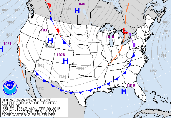
A low has traversed the State of Florida from west to east and a cold front will move south through the peninsula overnight. The low will then move slowly to the West and then Northwest, while the cold front plunges further south.
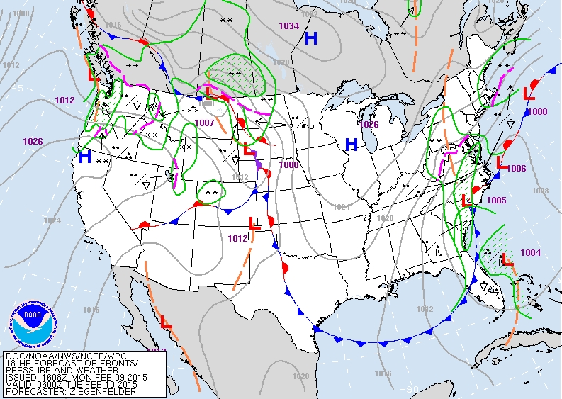 Later this week, another cold front will approach Florida and cross through the State on Thursday night. The timing of these fronts will dictate when and where the wind is offshore, so pay attention to the forecast maps and the flags.
Storm Details
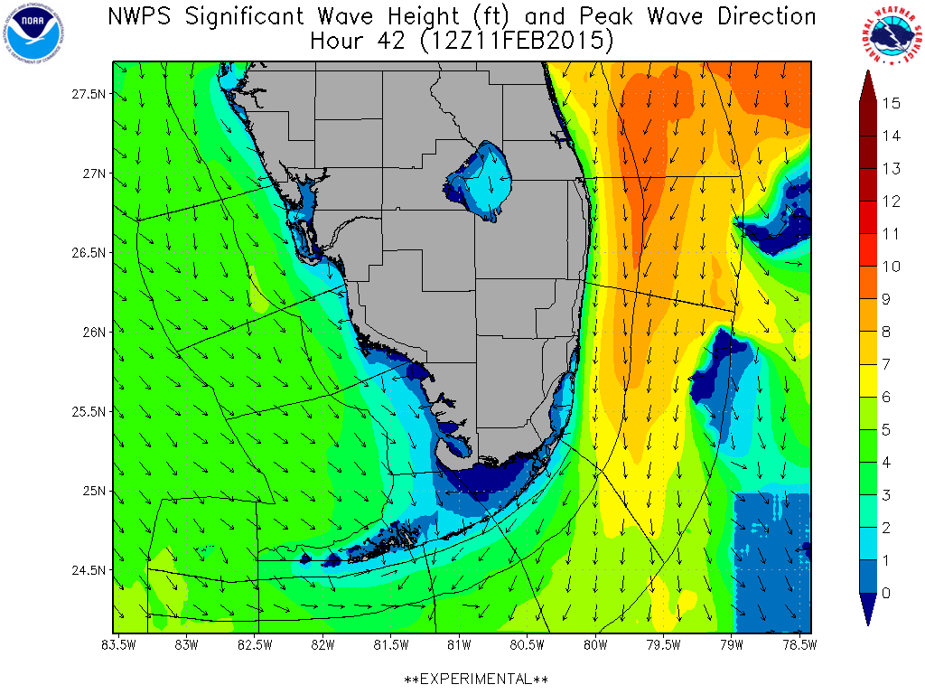
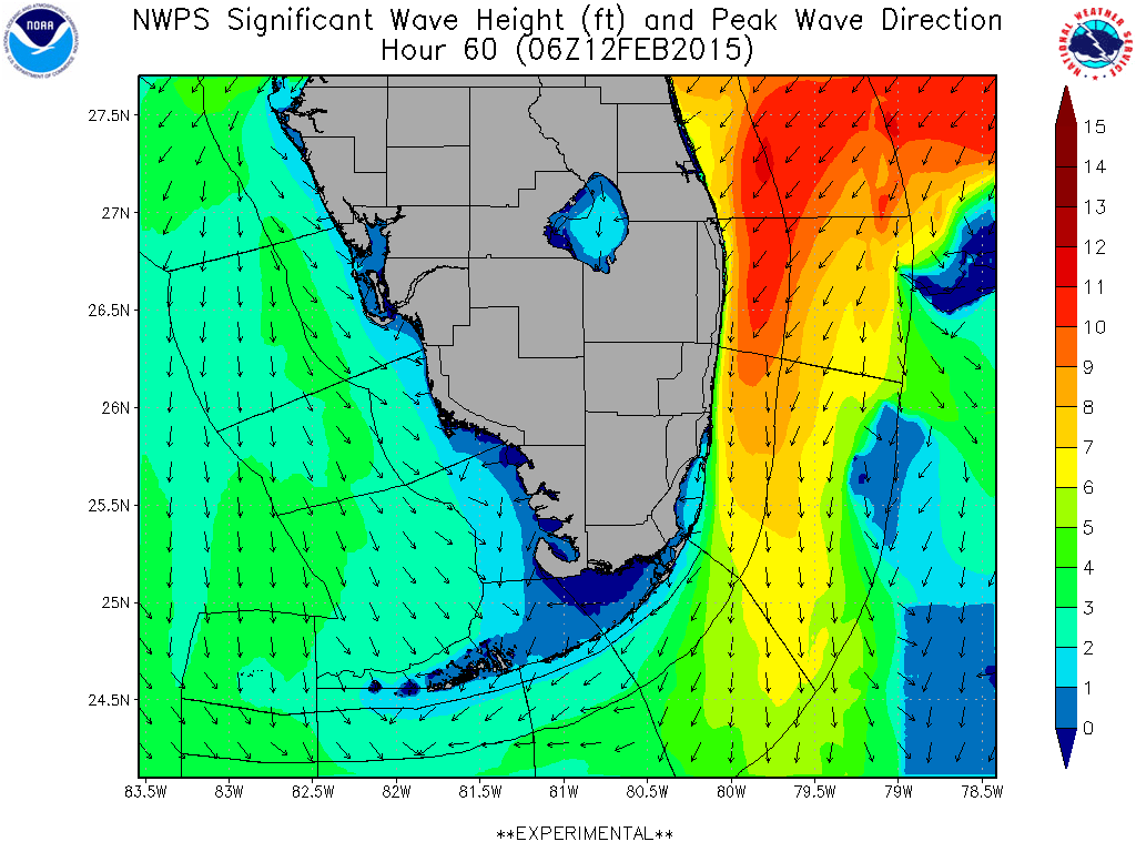
Due to the number of features impacting the weather during the week, this is a fairly complex forecast. The good news is that we’re looking at three swell makers and potential for offshore winds for periods of all of them. The first feature is the cold front that’s crossing through Florida on Monday night. This will set up a healthy flow of north winds behind the front, generating swell to arrive late Tuesday in to Wednesday. You can see the models picking up the North swell nicely below.
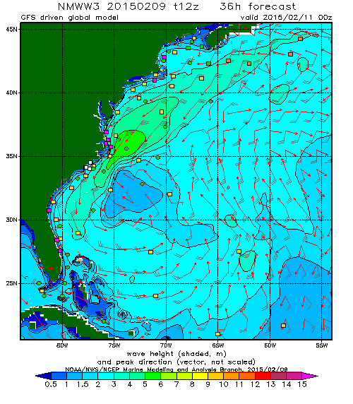
This swell should fade in to Thursday just as the swell from the low starts to kick-in. The low will set up some serious NE groundswell as it heads up the coast off the Carolinas. Check out the image below to see the low wrapping up with the previously mentioned North fetch being set up.
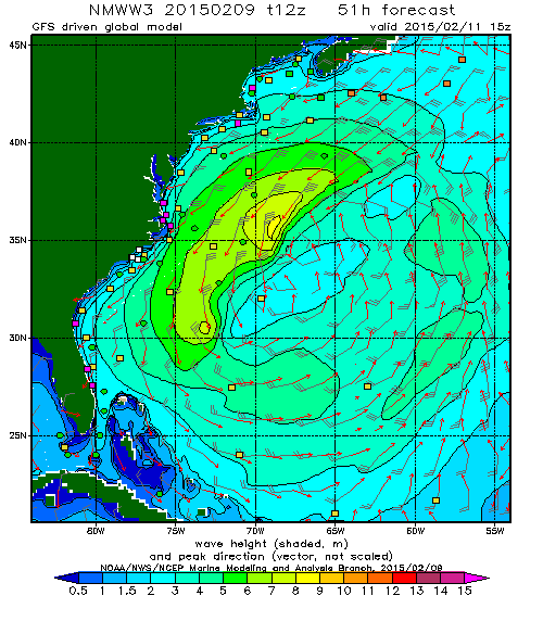
This swell looks to stick around for a few days since the low really cranks up and is putting down significant fetch. The image below shows the extent of the swell being generated by this low. It should be pretty large (by Florida standards)!
The next feature, a cold front, moves through on Thursday night. The cold front will set up another round of North winds with perhaps an even better/bigger hard tilt north swell behind it. You can see the combination of two swells, the NE from the low and the N from the cold front being picked up on the forecast below. Beyond that, there’s another front forecast for late in the weekend that looks to be stronger than these two. If believe the forecast 6-7 days out (which you really shouldn’t), a big north swell is headed our way for late Sunday/Monday. Something to watch. But in the meantime… tons of waves for South Florida.
Florida Forecast
Like mentioned above, the forecast for this week is pretty tricky due to the number of features impacting our area. Tuesday, watch for increasing North swell. The buoys upcoast should start picking up energy all day and through the evening peaking in very early Wednesday morning at nearly 8 feet at 8 seconds from almost straight north. The incoming swell then will start to turn more NE’ly and the period will increase to about 12 seconds as the low’s ground swell begins arriving. This longer period energy will top out in the 8-10 foot range on Thursday afternoon and slowly fade in to the weekend. The next cold front arrives right around the time the ground swell starts to peak, with a North windswell growing in it’s wake. This next hard-tilt North swell will hit at about 8 feet at 8-9 seconds, making it potentially better than the one earlier in the week. All in all, a lot of waves, with a great chance of seeing waves way down in to Broward and Miami-Dade. Palm Beach north will be biggest, especially during the NE ground swell.
Tuesday: Flat to perhaps a small bump arriving before dark.
Wednesday: Looks good for increasing swell all day. Up to head high at stand out spots with offshore/side-offshore winds.
Thursday: Palm Beach County sees solid groundswell in the shoulder to overhead range with offshore winds. Broward and Palm Beach might see some of this action, though the direction looks more NE than N. The last time this set up occurred, the swell made it all the way down south. ***UPDATE 2/12/2015*** Swell has made it all the way down south. Broward and Dade seeing solid surf. Palm Beach solid overhead. The forecast was way under-called. East Canaveral Buoy topped out at 19′ at 14 seconds!.
Friday: Reinforcing shot of North swell gets filtered all the way down south, while Palm Beach and north sees a combo swell of NE and N swell. Up to head high down south, but bigger in PBC. Winds looks offshore/side-offshore again. ***UPDATE 2/12/2015*** North swell not looking as big as initially forecast
Saturday: Very small down south, but still some nice leftovers in PBC. Up to shoulder high+ and fading.
Sunday: If the models prove correct, another bigger North swell to start building. Seriously? I hope so.
*NOTE* This forecast is subject to the timing/strength of the fronts. Things may slide a little bit back and trend bigger/smaller as we move from forecast to actual. That being said, looks like a good week to be a surfer in South Florida.
