Overview
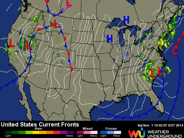
A cold front passed through the Florida peninsula bringing dry, cool air in to the region. Another, stronger cold front is currently making its way south. Currently, the front is pushing through Lake Okeechobee and is bringing another shot of colder air along with Northwest/North winds. This feature, combined with a rapidly deepening low off the Mid-Altlantic coast, will set up South Florida with a chance for some waves this weekend and in to next week.
Swell Generation Details
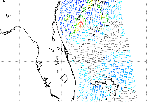
This forecast is pretty interesting for our first major cold front of the year since it combines two fronts and interaction with a deepening low of the Carolinas. The first front passed Florida on Friday which brought cooler, drier temps but not much wind. As you can see in the ASCAT wind pass below from Halloween day, there wasn’t too much fetch pointed our direction. Despite this limited fetch, we’re seeing a small North swell showing up all the way down in to Miami Beach. To me, this is a good sign for bigger surf on Sunday since the second front is packing a much larger punch. Then there’s the fact that there’s already some motion-in-the ocean that’s headed from North to South. That should help our second front build windswell on top of already agitated seas. And, when you’re dealing with a small swell window like found in far South Florida, it’s nice to see a little trace show up to let you know that the direction is North enough to make it down the Florida Straits. The next front is forecast to have even more of a northerly direction to start, so I’m pretty optimistic that we’ll see some waves as far South as Broward and Dade Counties.
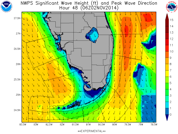
Unfortunately, the satellite for ASCAT winds missed the patch of ocean we’re watching for this system today, so we’re not able to see the latest wind field for the new cold front. Based on buoy readings in that region, it looks like we’re seeing much stronger winds than the last front’s winds (seen above). Right now, the wind still has a good amount of West in it, so swell generation isn’t really happening until they turn more Northerly. Even with a westerly component, we have the phenomenon of the “bounce, refracto or refraction” swells to think about here, but regardless, I’m optimistic that we’ll have enough true North swell to create some surf (in addition to whatever “bounce” action occurs with the WNW winds). You can see the North swell clearly in the graphic below for swell height on Sunday morning.
Florida Forecast
(Miami Beach to North Palm Beach County)
There’s a little north swell showing in South Florida with the far reaches of the state seeing a trace to barely rideable wave. Winds are light and west for now, but watch for those winds to become more strong and northerly later in the day and into the evening. By dark, we’ll really feel cold air advancing and temptures will plummet in to the 40’s and 50’s. Winds will be NW and strong in to Sunday before turning north and then northeast. Florida will see a period of strong NE winds after the frontal passage and the low departs off the Carolinas with a high pressure setting up in its place. So, waves and more waves. Maybe not the cleanest, but there’ll be surf.
Saturday: Trace north swell with sets in the rideable range for stand-out spots with West winds. Conditions change rapidly as the next front washes through the state accompanied with strong NW winds. Dropping temperatures and building swell overnight. Keep watching the buoys for swell in the 8 second range out of the north.
Sunday: I want to say that the swell will arrive at dawn with NW winds, but given the current conditions at upcoast buoys, I think the swell might show later in the morning. Possible “bounce or refracto” swell earlier, but the bulk the North swell should arrive midday. With any luck the wind will keep a westerly component for a few hours with swell. Best winds south, bigger swell north. Here’s a neat visualization for winds.
Monday: Leftover cold front swell being reinforced with NE winds. Onshore, but still waves.
Tuesday: Heavy onshores with building windchop and the wind trending more to the east.


