Overview
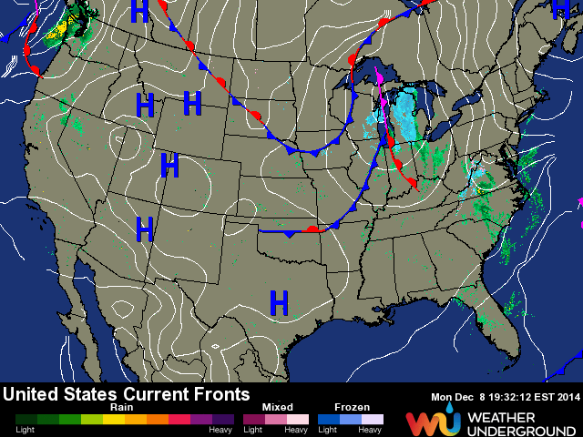
A trough from the Great Lakes to the Northern Gulf is forecast to move eastward and create conditions for more cold air to stream down the Florida Peninsula as we move through Monday night and in to Tuesday. The pressure gradient between this feature and a low deepening off the Mid-Atlantic/Northeast has created a significant Northeast fetch pointed at the East Coast. This Nor’Easter will create some serious (at least by East Coast standards) surf for the majority of the work week.
Storm Details
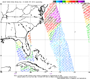
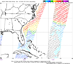
This storm is creating a really nice NE fetch pointed at a majority of the East Coast, including Florida from Palm Beach north. The advance of cold, Northerly winds is also creating a secondary North windswell that pales in comparison to the groundswell being generated by the Nor’Easter, but is worth watching for points south, including Broward and Miami-Dade County. The ASCAT winds images below clearly show a really good NE fetch stretching well up the coast in to the Mid-Atlantic and Northeast.
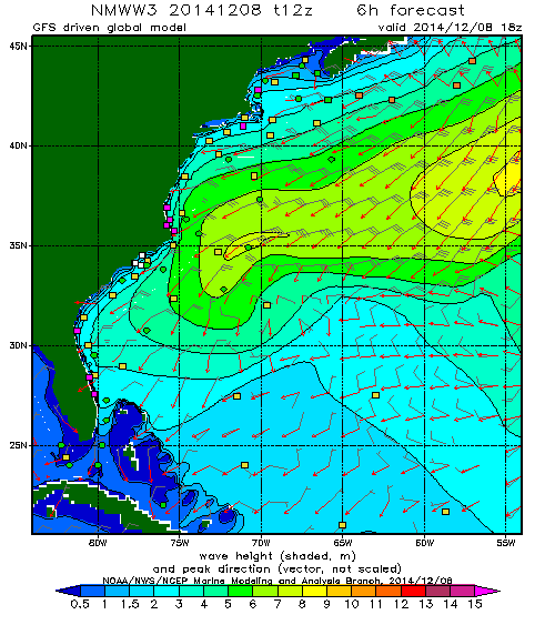
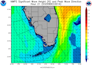
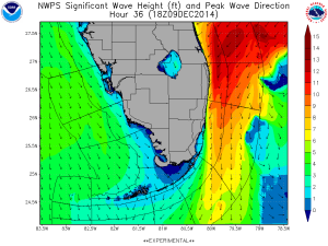
 The SWAN model and WaveWatch III both are showing a significant swell to hit the Florida coasts Tuesday through Thursday, with residual energy arriving Friday and even Saturday. As mentioned above, this is a very healthy fetch and will create some really solid energy. Swell heights of nearly 10 feet at 13-14 seconds are forecast for late Tuesday. Of note: the buoys are already pinging energy of nearly this size, which may indicate that the forecast is more conservative than what is actually occurring since swell is still being created. Watch the buoys. We don’t normally see numbers like this!
Florida Forecast
Look for rapidly building swell on Tuesday accompanied with increasing winds out of the North-Northwest. The speed and direction of the wind will be dependent on how quickly the trough advances, but there’s a good chance for a good window of surf before the winds really get going. Winds go more NW on Wednesday and begin to lighten. Thursday winds look even better with a more Westerly direction and super light all day. Swell peaks Tuesday afternoon and has some serious staying power, with a gradual decrease through the workweek.
Tuesday: Starts out with head+ high surf, and quickly builds through the day to well-overhead and maybe even double overhead at top spots in Northern Palm Beach County and further North. Most spots will be out of control and closing out with the exception of marquis waves. Winds are forecast to have a good amount of North and be gusting to near 20kts. Side-shore and big for most of the day. Broward and Miami-Dade might see some energy, but much, much smaller (and maybe better winds). If you are in doubt, don’t paddle out.
Wednesday: Solid NE groundswell with NW winds. Find your favorite “big wave” spot and bring a step-up. Could be a pretty classic day for South Florida at the right spots. Swell in the head to overhead+ range fading through the day. Maybe some refracto stuff further south.
Thursday: Swell continues to fade, but should still be plenty of energy to get head+ high waves at the best spots all day. Winds look really good, too. A good day to spread out the crowd and find your own sandbar.
Friday: Still some swell in the waist to chest range, maybe even better at better spots in Central Florida. Winds still should be nice and offshore.
Saturday: Yup, still some waves- especially in Central Florida. Waist high or so. Winds shouldn’t be too bad in the early hours, but will come up out of the North.
